|
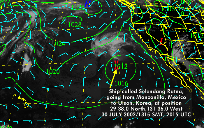
Subject: Bill's Position on July 30th (nine days into voyage) Date: Wed, 31 Jul 2002 From: Joseph Oster Based on the news from Nomi, I've plotted Bill's position here: And created an animated .gif of his approximate route using satellite weather data for each of the first nine days (WARNING!!! file size: 1.5 MBytes): ANIMATION Source of satellite imagery: Then, using these coordinates for: and a great circle calculator found here: http://williams.best.vwh.net/gccalc.htm Computed Bill's: Average speed, based on 710 miles in nine days: 79 miles per day, 3.3 knots ETA Hilo: August 17?, 27 days total, 18 days after contact with ship (1411/79) Bill has gone through some stormy weather at the tail end of tropical storm "Elida" up from Mexico. Winds are now very light in that area as he has gone west of the faded storm front and south of the straight line course to Hawaii. Aloha, Joseph Oster |
